Overview
A field campaign combining the tasks of two research projects funded by the Portuguese Polar Program (PROPOLAR), APMAR (Antarctic Peninsula precipitation and surface Mass balance: what is the role of Atmospheric Rivers?) and TULIP (Towards a better Understanding of the Link between cloud microphysics and precipitation during warm air Intrusions north of the Antarctic Peninsula), was carried out during February 2022. The field campaign took place at the Chilean Antarctic base Escudero (62°S; 59°W), located on King George Island, north of the Antarctic Peninsula (AP) (see Figure 1), with the objective of performing measurements to explore the impact of atmospheric rivers (ARs) on the surface mass balance (SMB) (part APMAR), and to investigate the role of liquid-containing clouds on radiative forcing and precipitation properties during warm/moist air intrusions associated with ARs and local moisture convergence.

Measurements
Radiosondes with high temporal resolution (every 3-6 hours) were launched during targeted events (including ARs), in addition to the regular radiosondes launched at Escudero station (daily at 00 UTC), to characterize warm/moist air intrusions associated with extratropical cyclones. 8 of the 18 radiosondes successfully launched during the campaign were equipped with Anasphere liquid and supercooled liquid water content (LWC+SLWC) sensors. Figure 2 shows an example of the data obtained from the radiosondes during the campaign.

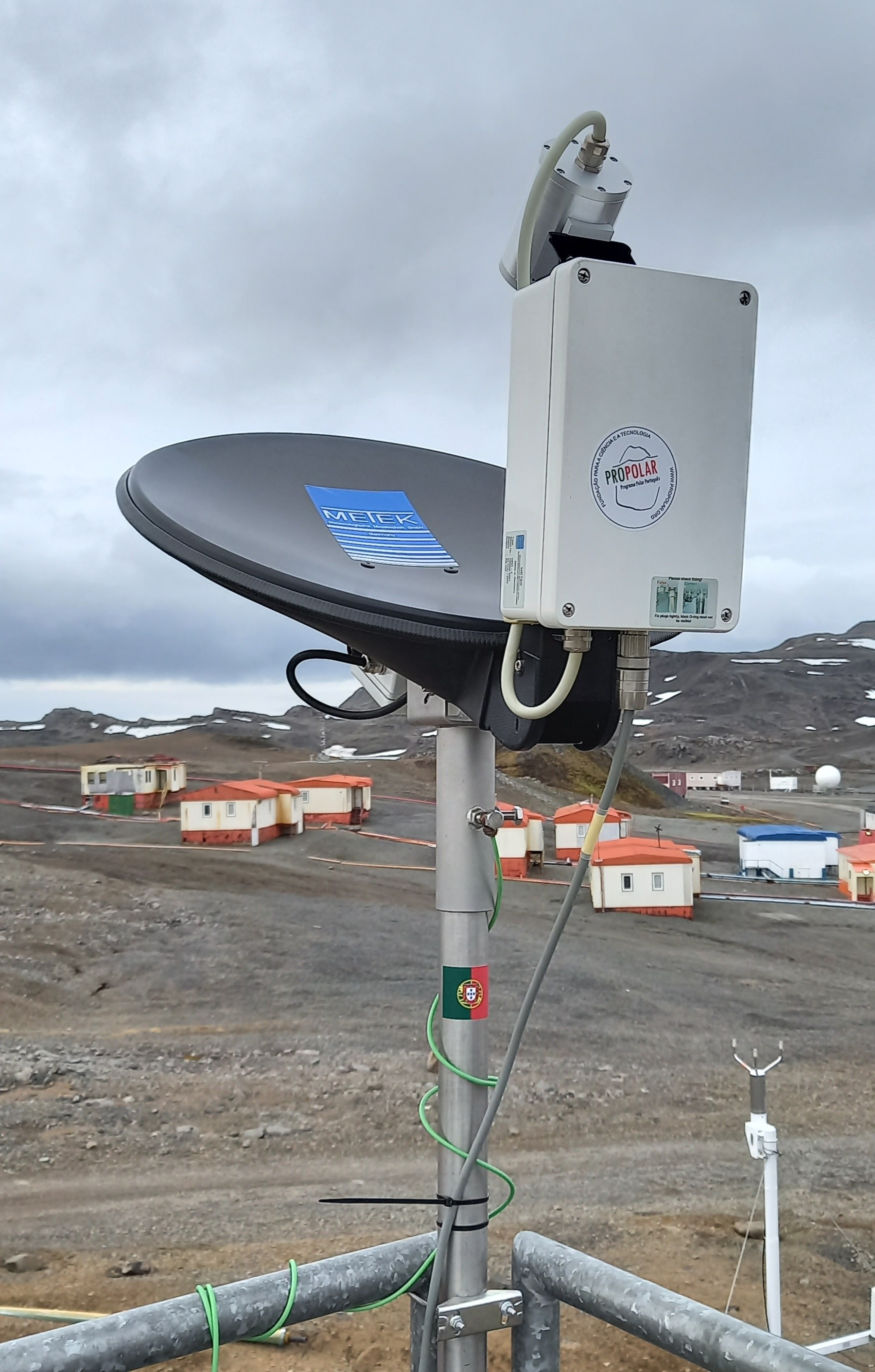
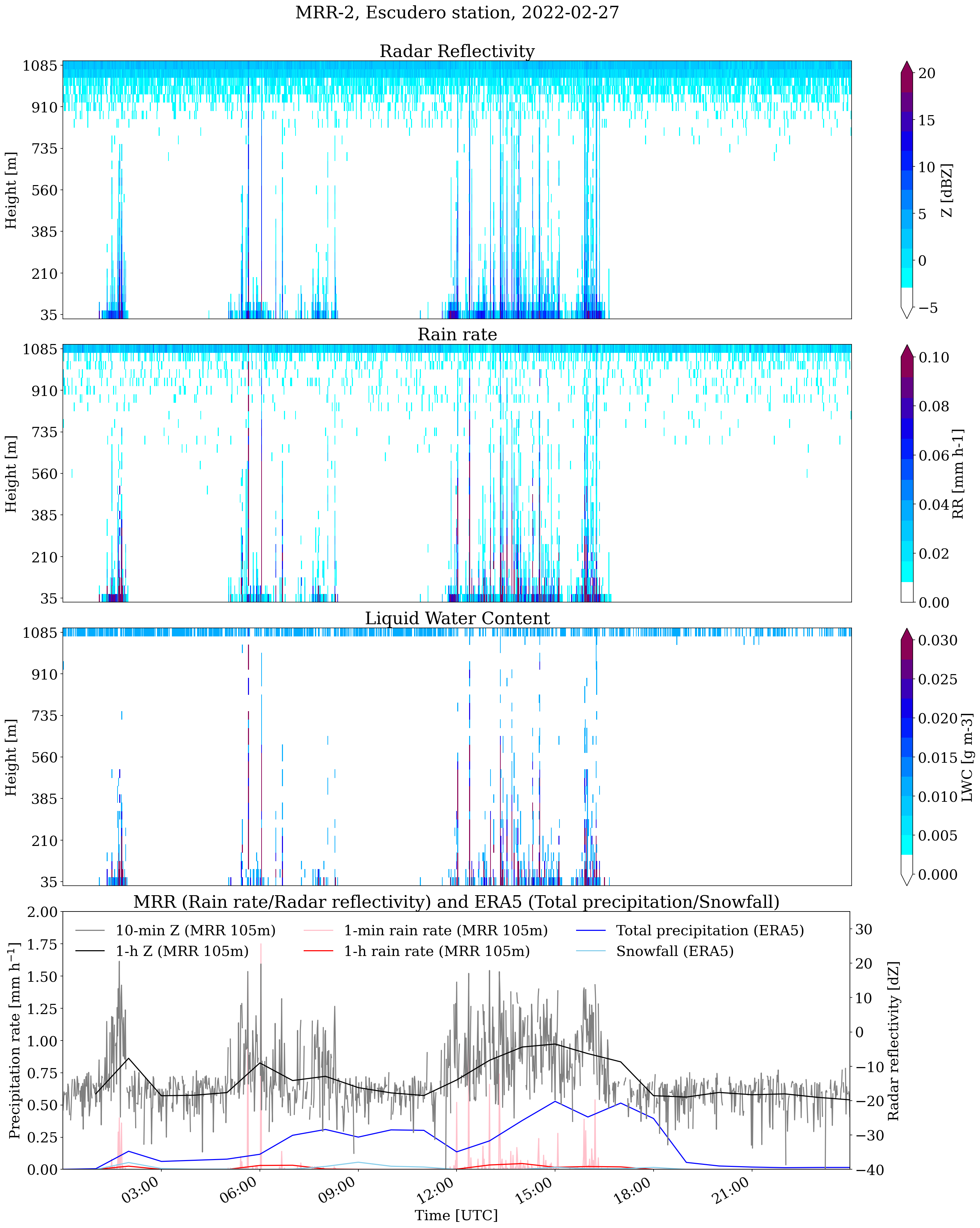
At the Escudero station, a vertically pointing K-band (24 GHz) micro rain radar (MRR) was installed (Figure 3) providing continuous measurements of vertical precipitation profiles with a vertical resolution of 35 m and a temporal resolution of 1 minute from approximately 100 m to 1 km above ground level. Figure 4 shows an example of the data obtained with the MRR compared to the ERA5 data.
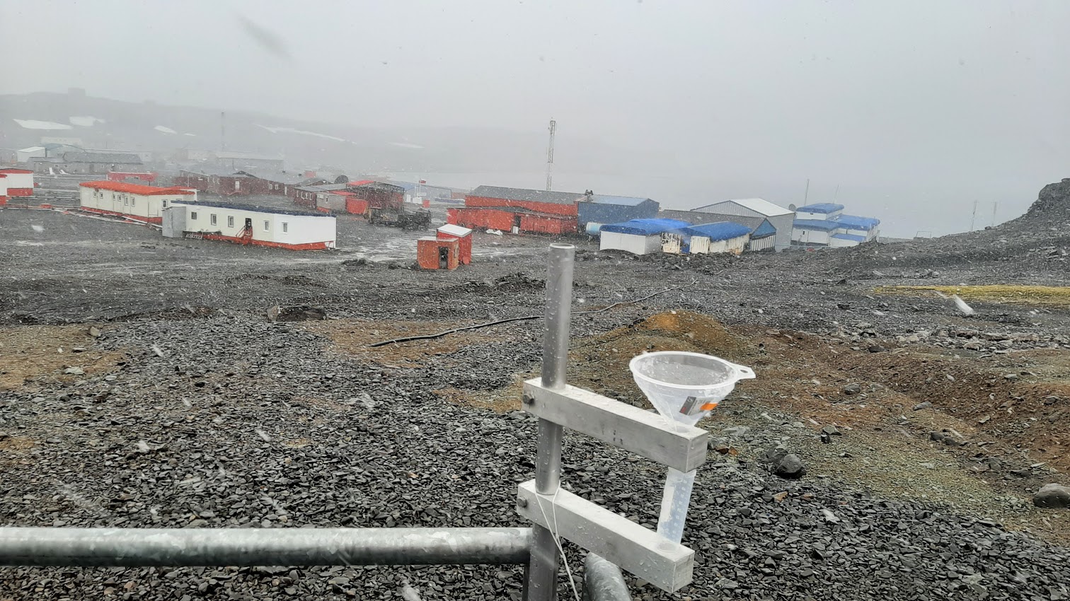
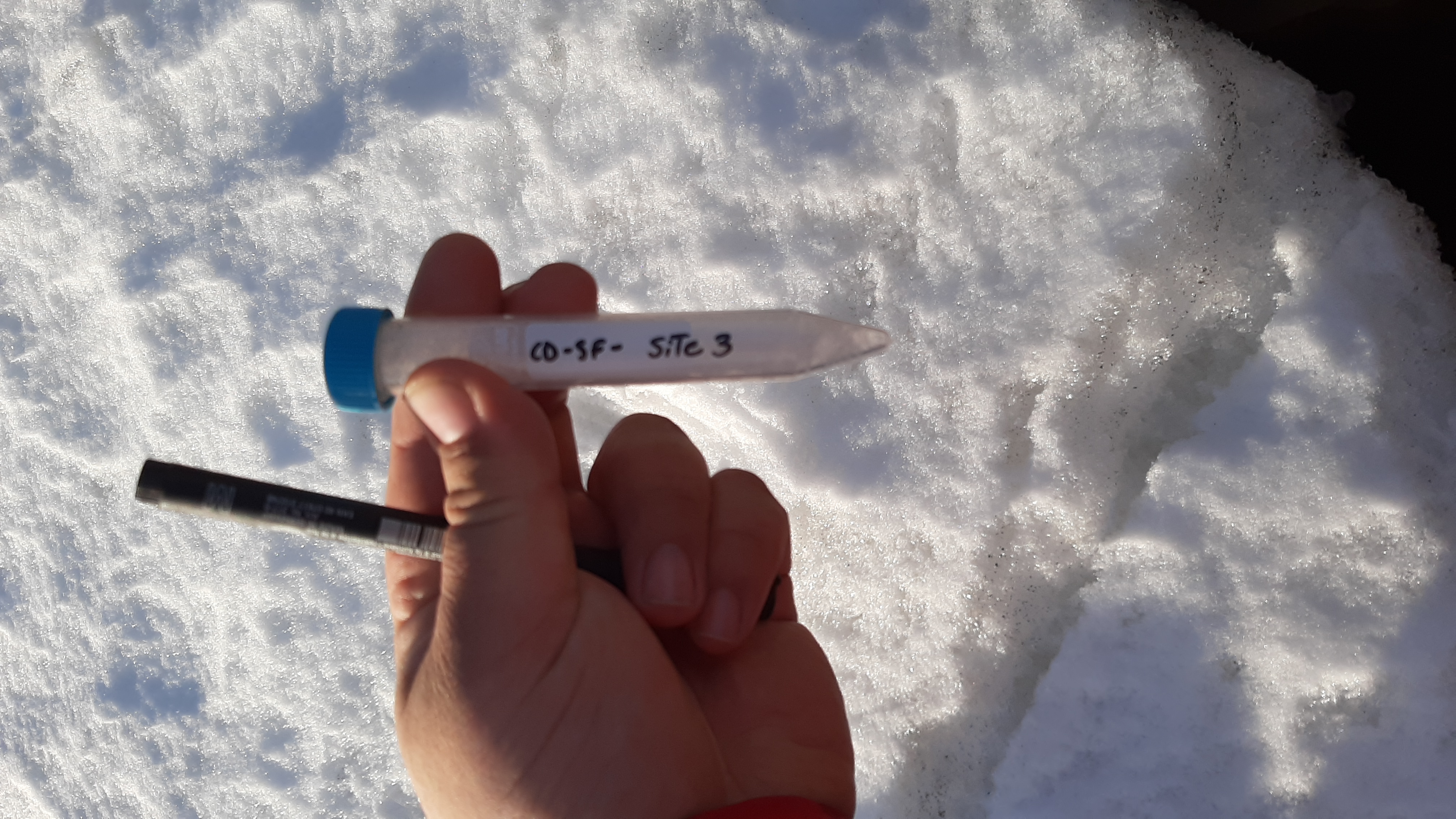
Snowfall, rainfall and surface snow samples were collected for further laboratory analysis of their stable isotope composition (see Figure 5 and 6). These observations will be analyzed together with the back trajectories and used to constrain the moisture source and pathways information.